NEW online flood data which aims to advise Canberrans areas at risk of riverine floods was launched today.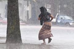
The data, on the ACTMAPi website, shows the one-in-100-year flood level areas in the ACT, according to Minister for Police and Emergency Services Simon Corbell.
“The flood data on the ACTMAPi website shows areas where there may be riverine flooding as a result of a major flood event that leads to the breaking of banks of a river or other similar large tributaries,” said Mr Corbell.
“Whilst most Canberra homes may not be subject to riverine flooding, people should not assume that they are not subject to any flood risk at all. They could still potentially be subject to flash flooding. This localised flooding occurs when heavy rain cannot drain away quicker than it falls.”
“The Molonglo River is the most obvious risk of riverine flooding, should there be a one-in-100-year flood event with the river.”
Ongoing work is being undertaken in relation to studies of other creeks outside the Molonglo River such as Sullivan’s Creek, Yarralumla Creek, Long Gully Creek, Weston Creek, Woolshed Creek, Tuggeranong Creek, Isabella Weir and Ginninderra Creek systems. As this information becomes available, it will be added to the ACTMAPi website towards the end of 2014.
The website can be viewed at actmapi.act.gov.au
Who can be trusted?
In a world of spin and confusion, there’s never been a more important time to support independent journalism in Canberra.
If you trust our work online and want to enforce the power of independent voices, I invite you to make a small contribution.
Every dollar of support is invested back into our journalism to help keep citynews.com.au strong and free.
Thank you,
Ian Meikle, editor


Leave a Reply