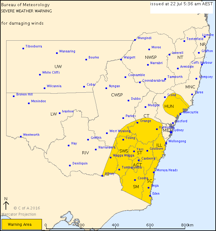
A STRENGTHENING west to northwesterly airstream is expected across New South Wales with a cold front that will move across the state on Friday and Saturday.
Damaging winds, averaging 60 to 70 km/h with peak gusts in excess of 90 km/h are forecast to develop across the southeast during Friday, extending northwards to parts of the Hunter and Mid North Coast late Friday or early Saturday. Elevated areas and some coastal valleys are most susceptible however parts of the Riverina and the central and southern western slopes could also be affected, particularly in association with shower activity. For alpine areas above 1900 metres winds are expected to average about 90 km/h with peak gusts in excess of 120 km/h.
Winds are expected to ease during Saturday.
Who can be trusted?
In a world of spin and confusion, there’s never been a more important time to support independent journalism in Canberra.
If you trust our work online and want to enforce the power of independent voices, I invite you to make a small contribution.
Every dollar of support is invested back into our journalism to help keep citynews.com.au strong and free.
Thank you,
Ian Meikle, editor


Leave a Reply