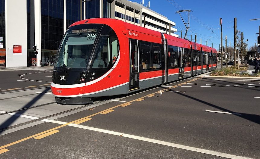
Canberra architect JACK KERSHAW says sending light rail over Commonwealth Bridge would sell Australia short, but he has another route in mind.
AUSTRALIA would sell itself short with the current troubled, expensive, destructive, disruptive, dangerous and intrusive, Civic to Capital Hill section of the proposed Civic to Woden tram line.
It uses Commonwealth Avenue (one side of the National Triangle), to connect City Hill to Capital Hill. However, the approval processes, even for the risky section from Civic to Commonwealth Park have not been completed by the Commonwealth.
The whole Civic to Capital Hill section needs to be re-cast because it has the following glaring, mostly visual/environmental, but also important technical, safety, and financial, shortcomings:
- It’s destructive of our unique Parliamentary Triangle (including from inevitable and inappropriate, unbalanced and view-destroying “land value capture” property development).
- It’s destructive of Commonwealth Avenue Bridge (including ruining its handsome bifurcation, that also matches Kings Avenue Bridge).
- It’s destructive of the important National Triangle symmetry.
- It’s very destructive of cultural landscapes, especially on and around Commonwealth Avenue South.
- It’s destructive of the City Hill precinct (including the loss of important engineering heritage infrastructure items, and protected natural species and biodiversity – the natural items were recently and belatedly referred to the Commonwealth Department of the Environment, with no decisions to date).
- Its protracted construction will be difficult and outlandish, especially at grade-separated London Circuit South and at State Circle, and be incredibly expensive and disruptive to traffic flows, with a dangerously and inconveniently located stop at City Hill South (that does not even appear to serve Commonwealth Park).
- It has been deemed to need expensive in-ground power supply infrastructure from Civic to Capital Hill and, indeed, to the far western end of Adelaide Avenue.
There is a more visually inspiring and inclusive alternative route, with less disruption, reduced cost and potentially increased operational revenue. And clearly, there’s time to examine the alternative in the usual way.
The alternative would be a unique and appropriate expression of modern, highly legible, sustainable public transport in the context of the central national area of our world-renowned, open-space capital.
It would stand in contrast with the current route’s knee-jerk “constipated orthodoxy”, an approach rarely seen in the designs of Walter Burley Griffin.
Briefly, the alternative route would:
- Take in Edinburgh Avenue, with New Acton, (very close to and connected by an existing pedestrian bridge to Acton Foreshore, and thence to Commonwealth Park),
- Then connect as directly as possible to Liversidge Street in and serving the ANU,
- Carry on over the existing land bridge that crosses Parkes Way,
- Extend down to the isthmus of Acton Peninsula,
- Rise gently along the southern shore of Acton Peninsula, so as to be above nominated flood levels. The route would serve the National Museum, the Australian Institute of Aboriginal and Torres Strait Islander Studies, and future developments on the peninsula, (it is important that the route avoids the verdant historical northern shore; and not spring from the tip of the peninsula, thus preserving its unique landform),
- Extend on to an elegant new curving sail-boat-friendly bridge (for trams, bikes, and pedestrians only) redolent of Griffin’s missing third central crossing (the new bridge being the subject of a properly constituted international design competition),
- Connect via say, a “shared zone”, to a better and sunnier (than cold, south-facing, narrow-gutted Acton Foreshore) public precinct at Lennox Gardens North/Flynn Place, the land inside the little used clover-leaf section of Flynn Drive, all near but respectfully separated from existing recreational areas and memorial gardens; preferably expanded through lake reclamation so as to match the Bowen Place foreshore line in symmetrically placed East Basin,
- Travel along Flynn Drive, with perhaps some appropriate land value capture development near the rear of Albert Hall and the Hyatt Hotel, and on currently cleared land opposite Lotus Bay; then on past the Chinese Embassy and other embassies nearby, and on to State Circle,
- And continue to Woden as currently planned.
The alternative route would receive more usage (notably at normally quieter off-peak times), because it is more inclusive for commuters, students, people gathering, relaxing, exercising or picnicking, as well as visitors to the national capital, by taking in the ANU, important Acton Peninsula, and the new Lennox Gardens North/Flynn Place precinct; and while still including the key tram stop at the junction of State Circle and Kings Avenue, providing access to Parliament House North, the Parliamentary Zone and Barton.
Who can be trusted?
In a world of spin and confusion, there’s never been a more important time to support independent journalism in Canberra.
If you trust our work online and want to enforce the power of independent voices, I invite you to make a small contribution.
Every dollar of support is invested back into our journalism to help keep citynews.com.au strong and free.
Thank you,
Ian Meikle, editor


Leave a Reply