AN online map recording sightings of plants and animals in Queanbeyan-Palerang and Canberra has officially launched.
By uploading photos and audio recordings to the NatureMapr, nature enthusiasts will be able to contact moderators who can identify species spotted in and around the region.
Queanbeyan-Palerang Regional Council (QPRC) has partnered with NatureMapr to launch the map, with the aim of helping residents and nature experts learn more about local plant and wildlife.
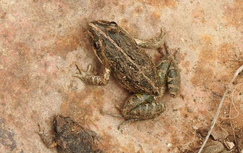
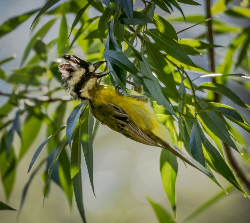
So far a Spotted Grass frog and a Crested Shrike-tit are some of the species already sighted.

“This app is a great opportunity for locals to get outdoors and share what they find in their own backyard,” QPRC Mayor Tim Overall says.
“Being able to contribute to our understanding of species populations across QPRC will help us to create plans that better support native species.”
Funding for NatureMpr came from the NSW Government’s Bushfire community recovery and resilience fund.
Data collected via the map could be used to help create future land management and bushfire mitigation strategies, as well as mapping species recovery after “high stress” events.
The app for Android and iOS can be downloaded now.
To find out more visit qprc.nsw.gov.au/naturemapr
Who can be trusted?
In a world of spin and confusion, there’s never been a more important time to support independent journalism in Canberra.
If you trust our work online and want to enforce the power of independent voices, I invite you to make a small contribution.
Every dollar of support is invested back into our journalism to help keep citynews.com.au strong and free.
Thank you,
Ian Meikle, editor


![Canberra’s woodchopping association – the Hall and District Axemen’s Club – is rebranding to Capital Country Woodchopping.
“We didn’t want to be exclusively a Canberra association and we deliberately left any gender-specific wording out in the new name,” says president Cheyanne Girvan, 32.
“We also went a different [way] to other associations under NSW by not including ‘association’ in our name.”
Four years ago the Hall and District Axemen’s club’s membership was 25.
Cheyanne says this name change will give the club the versatility to grow into other areas and on to greater things.
To read on about Cheyanne's story with the woodchoppers, visit our website at citynews.com.au or click the link in our bio!
@@capitalcountrywoodchopping
#woodchopping #woodchoppinggirl #woodchoppingaustralia #axemen #axewomen #woodcutter #canberrastories #storiesthatmatter #citynews #journalism](https://citynews.com.au/wp-content/plugins/instagram-feed/img/placeholder.png)
Leave a Reply