By Kathryn Magann in Sydney
TEMPERATURES have plunged by an average 10C across NSW as the heatwave that gripped much of the state starts to wane while soaring temperatures in SA give way to flooding rain.
Temperatures climbed into the low to mid 40Cs across central western and coastal parts of NSW on Saturday before a strong southerly buster swept up the coast, bringing thunderstorms and a welcome drop in temperature.
In Canberra the maximum is forecast to be 29C with the slight chance of a shower on Sunday. The bureau says there’s also the chance of a thunderstorm during the afternoon and early evening, possibly severe. Working week maximums ranging from 30C to 33C.
Clean-up efforts are underway after strong winds brought down trees, powerlines and many roofs.
The NSW State Emergency Service said the winds damaged several homes on the Central Coast leaving one home uninhabitable as roofs were ripped off during the storm burst.
Volunteers responded to 297 incidents across the state with Long Jetty bearing the brunt of the damage, recording 121 incidents in the last 24 hours.
Northen Zone Deputy Unit Commander Superintendent Peter Keegan said 17 storm teams are on the ground and 58 incidents are still being attended to.
“A number of properties have seen impacts, with 10 persons displaced due to the storms,” he said in a statement on Sunday.
“While the storms have eased, we are still in the middle of storm season, which means we can see severe weather at any time.”
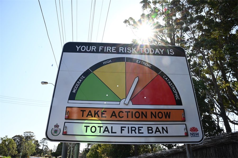
While coastal areas will experience milder conditions following the southerly wind change, inland NSW will see widespread high fire danger, the RFS warned.
As of 9am on Sunday there were 86 fires burning across the state, 26 of which are yet to be contained with a total fire ban in place for parts of NSW.
In SA, a severe weather warning was issued for the Eyre Peninsula, West Coast, and North West Pastoral districts for heavy rainfall on Sunday.
Damaging winds are expected late Sunday and Monday morning affecting the Mount Lofty Ranges and parts of Adelaide metro, mid north and Murraylands.
Angus Hines, from the Bureau of Meteorology, said a long band of rain stretching from eastern Victoria across southern SA up towards the north west had prompted the major rain warnings.
“The southern part of central SA becomes the focus point for quite heavy rain on Sunday – persistent falls, pretty much all day,” he said.
As much as 100m of rain could fall over the eastern part of the Eyre Peninsular – well more than December averages of 15mm to 30mm.
“So, for a lot of places, this weekend will represent two months of rainfall, if not more than that, for this time of year,” Mr Hines said.
Victoria, Tasmania, the far south of NSW and parts of the NT can also expect high rainfall totals across the weekend.
NSW Premier Chris Minns said summer was a season of extremes.
“It’s going to be a season of extremes with major weather events,” he told Sky News on Sunday.
Who can be trusted?
In a world of spin and confusion, there’s never been a more important time to support independent journalism in Canberra.
If you trust our work online and want to enforce the power of independent voices, I invite you to make a small contribution.
Every dollar of support is invested back into our journalism to help keep citynews.com.au strong and free.
Thank you,
Ian Meikle, editor


Leave a Reply