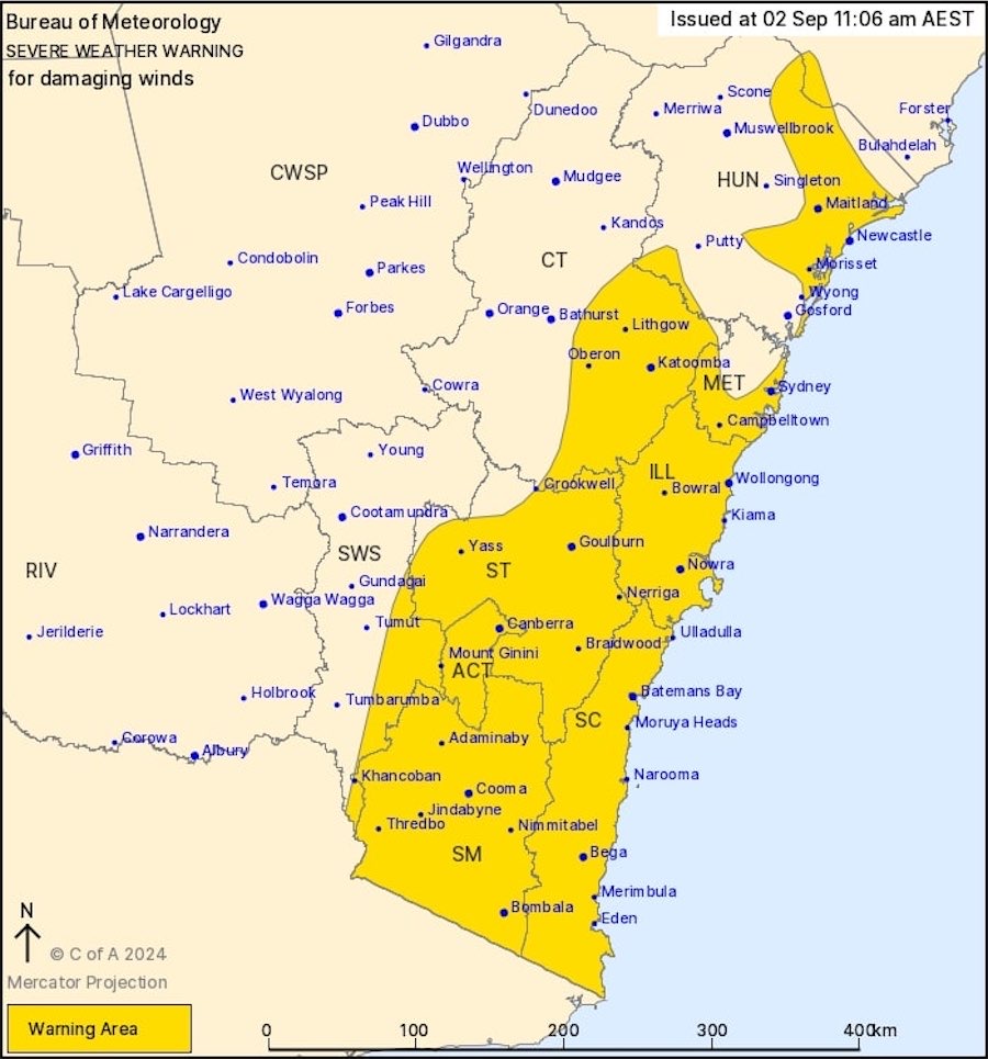
At its late morning update the Bureau of Meteorology has affirmed its earlier severe weather warning for damaging winds across the ACT on Monday.
It says a strong westerly flow over southeast Australia will peak over NSW and ACT as an embedded low moves out of Bass Strait and an associated cold front crosses southern to central parts of NSW during the day.
It is forecasting possible damaging winds averaging 60 to 70 km/h with peak gusts up to 100 km/h over higher elevations during the late morning and early afternoon for the ACT, including Canberra, Goulburn and Yass, the south coast, Southern Tablelands, Snowy Mountains and South West Slopes.
The risk of damaging winds is expected to become confined to higher elevations in the south by the evening and ease below warning thresholds in the late evening.
Who can be trusted?
In a world of spin and confusion, there’s never been a more important time to support independent journalism in Canberra.
If you trust our work online and want to enforce the power of independent voices, I invite you to make a small contribution.
Every dollar of support is invested back into our journalism to help keep citynews.com.au strong and free.
Thank you,
Ian Meikle, editor


Leave a Reply