By Keira Jenkins and Melissa Meehan
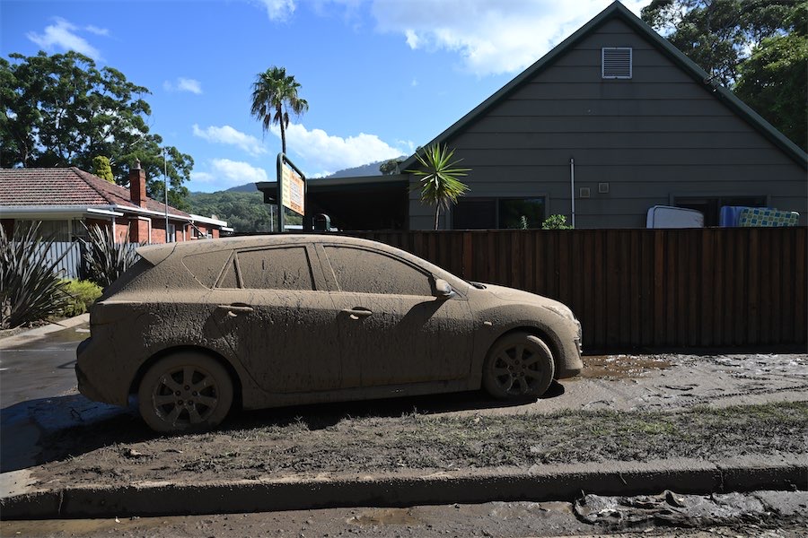
The damage from record-breaking downpours in NSW is being assessed as flood waters recede.
The Hawkesbury River, northwest of Sydney, peaked above the major flooding level at North Richmond late on Saturday night, albeit two metres below peaks reached in major floods in 2021 and 2022.
With rain easing and river levels beginning to subside, the clean up is under way.
SES volunteers began assessments in the Illawarra on Sunday, finding 57 properties damaged in the storms, while 28 were inundated with floodwater and 14 deemed non-habitable.
With about 800 people in the Sydney region still under emergency evacuation warnings, SES commissioner Carlene York says the danger is not over.
“There’s still a lot of roads cut and there’s still a lot of danger out there,” she said from Windsor.
“That will obviously worsen as the night comes, not with the rain but with the ability to see what’s on the road.”
In the last 24 hours, we’ve received 1877 incidents including 146 flood rescues.
There had been “way too many” people rescued from floodwaters over the weather event, she said.
“There’s been vision of people on the roofs of their cars and some really dangerous situations where my SES volunteers have been placed in danger.”
Rain on Friday and Saturday caused landslips, flash flooding and a house in Wollongong to be swept into a creek. Witnesses reported seeing two people emerge from the mangled home in Mount Keira.
Investigations are also continuing into the death of a man found in water in Penrith.
Emergency Services Minister Jihad Dib said a number of shires impacted by the flood will be covered by a natural disaster declaration, triggering financial assistance for residents.
“We can’t control the weather and we can’t control the impact of the weather,” he said.
“We’ve learned from past disasters to make sure we are better at addressing the way that we deal with natural disasters.”
WaterNSW said Sydney’s Warragamba Dam was continuing to spill but only at half the rate of Saturday’s peak. The reservoir’s radial gates were expected to be closed late on Sunday.
The Bureau of Meteorology’s Sarah Scully said there was still a significant amount of water needing to make its way downstream, although the worst of the rain had passed.
“We’re at the tail end of this weather event with the flood conditions set to improve,” she told AAP.
“There’s no significant rainfall forecast over the next few days, which is good news for the recovery.”
Meanwhile, moderate rainfall is forecast for the already soggy southeast Queensland and northern NSW regions.
“In that region the grounds are just so wet that flash flooding is still possible just with moderate rainfall totals so its something for the community to be aware of,” Ms Scully said.
A major flood warning is in place for the usually intermittent Warrego River in Queensland’s southwest.
Major flooding is also expected for the Balonne and Weir rivers.
Who can be trusted?
In a world of spin and confusion, there’s never been a more important time to support independent journalism in Canberra.
If you trust our work online and want to enforce the power of independent voices, I invite you to make a small contribution.
Every dollar of support is invested back into our journalism to help keep citynews.com.au strong and free.
Thank you,
Ian Meikle, editor


![For graphic designer Tracy Hall, street art is like any artwork, her canvas has been swapped out for fences and plywood, her medium changing from watercolours to spray paint.
A Canberra resident for 13 years, Tracy has been a street and mural artist for the past five.
Her first exploration into grand-scale painting was at the Point Hut toilets in Banks five years ago. “They had just finished doing up the playground area for all the little kids and the words [of graffiti] that were coming up weren’t family friendly,” she says.
“So I ended up drawing this design and I got approval for the artwork.”
Many of Tracy’s time-consuming artworks are free, with thousands of her own dollars put into paint.
@traceofcolourdesigns
To read all about Tracy's fabulous street art, visit our website at citynews.com.au or tap the link in our bio! 🎨🖌
#canberranews #citynews #localstories #canberrastories #Citynews #localnews #canberra #incrediblewomen #journalism #canberracitynews #storiesthatmatter #canberralocals #artist #streetart #streetartist #StreetArtMagic](https://scontent.cdninstagram.com/v/t39.30808-6/490887207_1225841146218103_6160376948971514278_n.jpg?stp=dst-jpg_e35_tt6&_nc_cat=106&ccb=1-7&_nc_sid=18de74&_nc_ohc=MUiEmedc4VAQ7kNvwHTUMX_&_nc_oc=Adk-5HjcsfQwB-n_l8zetmr0YqMaupGjrl2gNVCZdsmkxwn-oqjBg_V7pLtGggCE43s&_nc_zt=23&_nc_ht=scontent.cdninstagram.com&edm=ANo9K5cEAAAA&_nc_gid=3fjL16DA7WDFMmGuPmhczg&oh=00_AfG9D9FLSkek_ss8Me1cdnfGfXnkGWa8LRuaBCdFrEzzug&oe=680991D4)


Leave a Reply