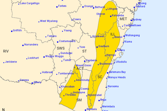
DAMAGING winds averaging 60 to 70 km/h with peak gusts in excess of 90 km/h are possible over the Snowy Mountains and the ranges to the west of the ACT, the Bureau of Meteorology has forecast in a severe weather warning this afternoon (July 17).
It is the result of a cold front is crossing over south-east NSW, strengthening west to northwesterly winds over elevated areas.
The bureau says winds will remain strong throughout most of today until a second front passes to the south-east of Australia.
The NSW National Parks and Wildlife Service recommends that back-country travel be postponed until conditions improve.
Winds are expected to continue during today, before slowly easing to below severe thresholds late tonight.
Regional areas that may be affected include Bowral, Braidwood, Goulburn, Cooma, Mount Ginini, Jindabyne, Perisher Valley, Charlotte Pass, Thredbo and Adaminaby.
Mt Boyce recorded a 104km/h wind gust at 10.14am.
Who can be trusted?
In a world of spin and confusion, there’s never been a more important time to support independent journalism in Canberra.
If you trust our work online and want to enforce the power of independent voices, I invite you to make a small contribution.
Every dollar of support is invested back into our journalism to help keep citynews.com.au strong and free.
Thank you,
Ian Meikle, editor


Leave a Reply