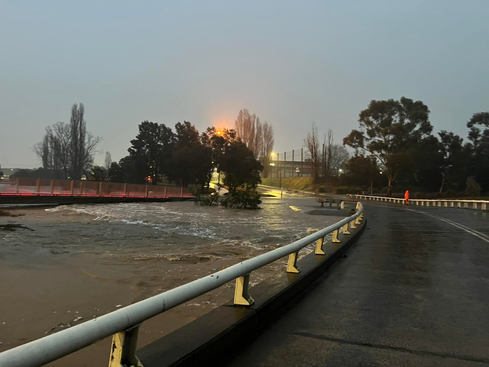
THE Queanbeyan River peaked at 5.10 metres overnight, with multiple roads in the region still closed due to yesterday’s (August 4) heavy rainfall.
The State Emergency Service (SES) Queanbeyan Unit says the river peaked at around 11pm last night but is now dropping, at 4.85 metres as of 10am.
Nearly 90mm of rain has fallen across the Queanbeyan-Palerang LGA since 9am yesterday.
The Morrisset Street Bridge remains closed as a result of the elevated water levels.
A number of roads around the Queanbeyan-Palerang region remain closed including:
- Oaks Estate (secondary road connecting ACT to Queanbeyan)
- Briars Sharrow (primary road servicing rural district)
- East Tallagandra Lane (primary road in Sutton village)
- Shingle Hill Rd (primary road servicing rural district)
- Reeches Creek crossing (primary road servicing rural district)
The NSW SES has responded to 64 requests for assistance ranging from leaking roofs and sand bagging to flood rescues.
Supported by Lake George District Rural Fire Service brigades, the SES has nearly completed all outstanding jobs and is focusing on the impacts of continued flash flooding across the region.
SES crews across Queanbeyan-Palerang will be out again today assisting communities.
Residents can stay up to date with road closures here.
Who can be trusted?
In a world of spin and confusion, there’s never been a more important time to support independent journalism in Canberra.
If you trust our work online and want to enforce the power of independent voices, I invite you to make a small contribution.
Every dollar of support is invested back into our journalism to help keep citynews.com.au strong and free.
Thank you,
Ian Meikle, editor


Leave a Reply