By Savannah Meacham and Laine Clark in Brisbane
Time is running out for millions of people in built-up coastal areas trying to prepare for a tropical cyclone bringing destructive winds and flooding.
Southeast Queensland is bunkering down, with schools, public transport and major roads to close as Tropical Cyclone Alfred approaches.
The category two system is expected to make landfall late on Thursday or early Friday between Queensland’s Sunshine Coast and Gold Coast.
The first cyclone to hit the state’s southeast since 1974, Alfred will trigger heavy rain, flash flooding, destructive winds and storm surges with wild weather expected from Wednesday.
People have begun fleeing their homes with about 70 evacuations from South Stradbroke Island, where the eye of the cyclone is set to loom early on Friday.
Evacuation centres are opening across the region but residents have been urged to stay with family or friends if they can.
Hundreds of emergency services are doorknocking high-risk areas, warning residents to leave, with the cyclone’s arrival likely to coincide with a Friday morning high tide.
About 20,000 properties are expected to be impacted by flooding in the Brisbane area, prompting the warning for locals to consider relocating.
“We don’t go forcibly drag people out of their homes … police will go around and say to people ‘you need to leave your home now’,” Acting Commissioner Shane Chelepy said.
“Those people who don’t leave their homes … that puts you, your family and us in a really dangerous situation.”
Aged care facilities in low-lying areas are being evacuated on Wednesday and authorities are working to accommodate the region’s homeless.
The federal government has initiated defence force assistance with heavy-lift helicopters pre-positioned in Bundaberg and Coffs Harbour.
“This is a rare event to have a tropical cyclone in an area that is not classified as part of the tropics,” Prime Minister Anthony Albanese said in Brisbane on Wednesday.
Hundreds of schools spanning the Sunshine Coast to northern NSW will close on Thursday and Friday.
Public transport will cease late on Wednesday night across the region with major bridges to close when wind gusts reach 90km/h.
Flood releases are likely at Queensland’s Somerset and Wivenhoe dams in the next two days, with several ungated dams already spilling.
Qantas on Wednesday cancelled a number of flights, Carnival Luminosa’s three-day cruise was called off and Greyhound bus services from Brisbane axed.
The cyclone’s impact is also set to be felt interstate, with the warning zone spanning Double Island Point, Queensland to Grafton, NSW.
More than 100 schools have closed in the Northern Rivers region, with locals urged not to panic-buy.
“Thursday is the day to act because Thursday evening and Friday morning we’re expecting the storm to approach and cross into NSW,” NSW Premier Chris Minns told ABC News.
Farmers from the Tweed and Northern Rivers down to the Mid North Coast have been urged to prepare for damaging winds, high tides and heavy rainfall.
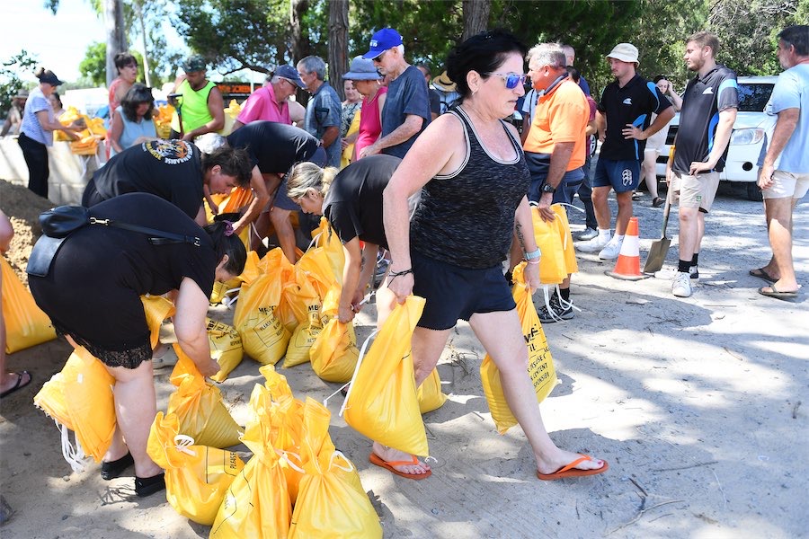
Emergency alerts were issued across the southeast on Wednesday afternoon after “chaos” at sandbagging sites as many people made last-minute preparations.
The federal government promised the delivery of 250,000 extra sandbags on Wednesday to keep up with demand after many queued for hours.
Who can be trusted?
In a world of spin and confusion, there’s never been a more important time to support independent journalism in Canberra.
If you trust our work online and want to enforce the power of independent voices, I invite you to make a small contribution.
Every dollar of support is invested back into our journalism to help keep citynews.com.au strong and free.
Thank you,
Ian Meikle, editor


Leave a Reply