By Tracey Ferrier in Brisbane
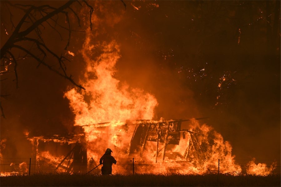
AS parts of Australia swelter through searing September heat and dangerous fire conditions, the weather bureau has declared a double whammy that raises the risk of more of the same.
The Bureau of Meteorology has formally declared both an El Nino event in the Pacific Ocean, to Australia’s east, and a positive Indian Ocean Dipole, to the country’s west.
El Nino events typically deliver drier conditions for much of the country, but particularly eastern Australia, as well as above-average temperatures.
A positive IOD often results in less rainfall than average over parts of Australia.
When the two patterns coincide it can magnify the drying effects.
“Both these climate drivers have a significant influence on the Australian climate, in particular favouring warmer and dryer conditions, particularly over spring, but also into early summer,” bureau manager of Climate Services Karl Braganza said on Tuesday.
“Those conditions are accompanied by an increase in fire danger and extreme heat risk.
“It’s really up to individuals and communities now to prepare for a summer of heat and fire hazards.”
The declaration coincides with severe weather warnings for swathes of Australia’s south east, including very hot spring conditions, elevated fire dangers and strong winds fuelled by an approaching cold front.
Large parts of NSW and eastern Victoria are enduring maximum temperatures 10 to 15 degrees above the September average.
A heatwave warning is in place for the NSW south coast, and a catastrophic fire danger warning is also current for the far south coast.
Damaging winds, driven by a cold front, are compounding the danger.
The front has triggered severe weather warnings for parts of SA, Tasmania, Victoria and southern NSW, with the possibility of showers, storms, small hail and snow in some parts.
And while that will bring welcome relief from the heat in Victoria and NSW, the front will drive the extreme heat further north, into Queensland, with the effects most pronounced there on Thursday.
Fire dangers will also pick up across the state, particularly in the south, with the Channel Country expected to reach extreme fire dangers on Thursday and Friday.
Who can be trusted?
In a world of spin and confusion, there’s never been a more important time to support independent journalism in Canberra.
If you trust our work online and want to enforce the power of independent voices, I invite you to make a small contribution.
Every dollar of support is invested back into our journalism to help keep citynews.com.au strong and free.
Thank you,
Ian Meikle, editor


Leave a Reply